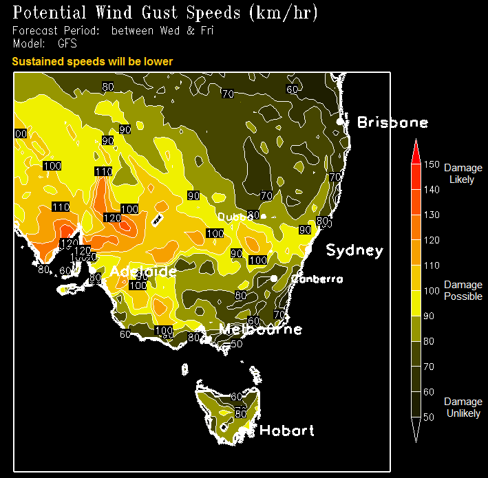
Damaging wind gusts of 50 to 60 km/hour with peak gusts of around 100 to 110 km/hour in elevated areas and with thunderstorms are possible from later today (Wednesday) into early Thursday morning.
The Bureau of Meteorology (BoM) has issued Flood Watches for both the Goulburn Broken and North East river catchments. The Hume region catchments are still saturated after recent flooding and with the forecast rainfall, renewed river and creek rises are expected with minor to moderate level flooding likely to develop from Thursday afternoon.
For the North East and Alpine areas, thunderstorms are forecast for the North East catchments from midnight Wednesday through to Thursday morning bringing rain with possible heavy rainfall of 10 to 25 mm likely, with higher totals of up to 50 mm possible on the ranges. This may lead to flash flooding and is forecast to fall over a 6 to 9 hour period.
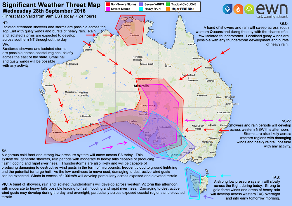
In the Goulburn and Broken catchments, rain with possible heavy falls and thunderstorms are forecast from early Thursday morning with rainfall totals of 15 to 40 mm likely, with higher totals of up to 60 mm possible on the ranges.
A second low pressure system is expected to develop on Friday, bringing rainfall of 10 to 20mm through the North East catchments, and 5 to 20 mm across the Goulburn Broken catchments. Rain is then expected to ease during Saturday morning and clear in the afternoon.
Wild storms like this can cause:
- Wind damage to buildings, including roofs, sheds collapsing and trampolines becoming giant flying kites with the potential to cause damage and maybe kill or injure someone.
- Trees to blow down over roads and onto powerlines, especially with the soggy soils, causing a loss of power in some areas. Never take shelter or park your car under trees.
- Flash Flooding which comes and goes quickly, can be deep and fast moving enough to wash vehicles off roads and damage bridges.
- Heavy rain which overflows spouting and gutters, leaking into roofs, ceilings or down walls.
- Riverine flooding of creeks and rivers flooding low-lying farmland, parks, bike tracks and walking trails, sporting grounds, caravan parks, fishing spots and camping areas may be flooded. Farmers are advised to move livestock and equipment to higher ground immediately and moderate flooding may result in floodwater over roads, into front and back yards of homes and shed or garages.
For emergency assistance during storms or floods, call VICSES on 132 500.
For life threatening emergencies call 000.
For the latest emergency warnings and advice go to: www.emergency.vic.gov.au
For more about flood and storm safety, how to get ready and know what to do go to: www.ses.vic.gov.au/getready